724
FXUS66 KSGX 160432
AFDSGX

Area Forecast Discussion
National Weather Service San Diego CA
932 PM PDT Wed Apr 15 2026

.SYNOPSIS...
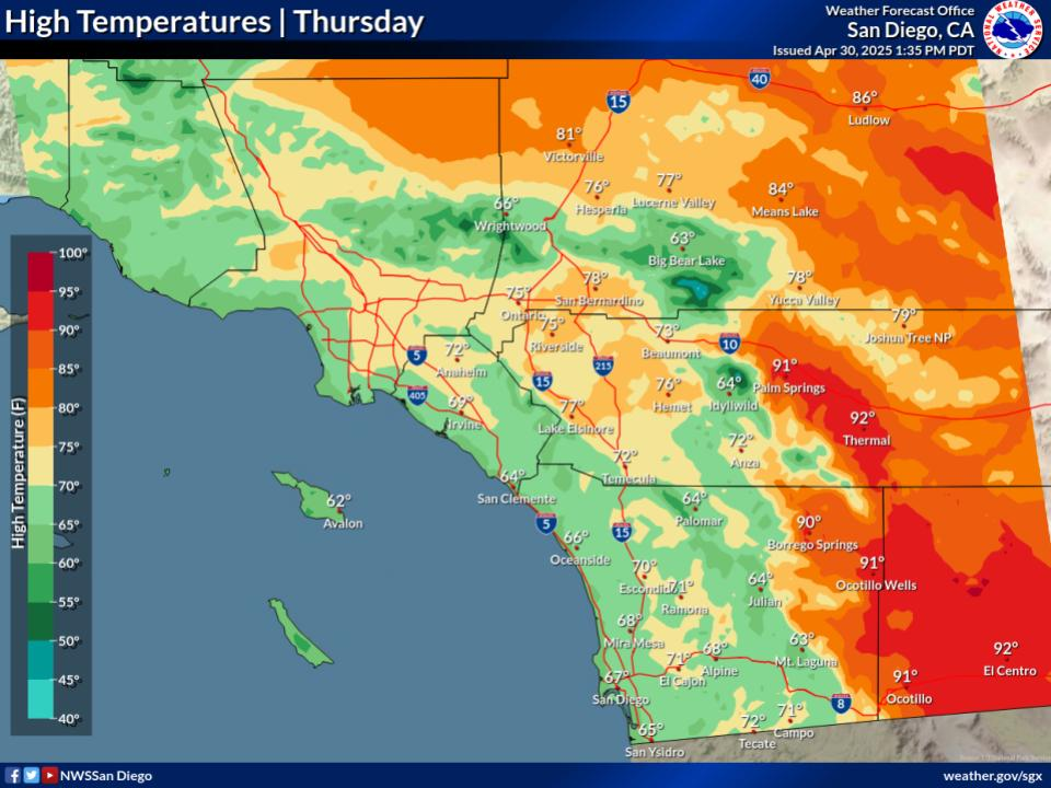
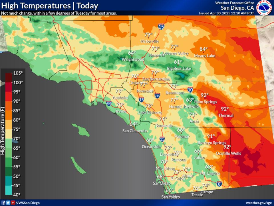
High temperatures near normal Thursday with southwest to west
winds for the mountains and deserts gusting to 35 to 45 mph. Winds
turn offshore on Friday with northeast winds along and below the
coastal slopes of the mountains gusting to 35 to 45 mph. Warmer
with weaker winds for the weekend with high temperatures warming
to around 5 to 10 degrees above average. Cooler and breezy early
next week as a low pressure system moves toward the California
coast, but there remains a large amount of uncertainty in how this
system progresses.

&&

.DISCUSSION...FOR EXTREME SOUTHWESTERN CALIFORNIA INCLUDING ORANGE...
SAN DIEGO...WESTERN RIVERSIDE AND SOUTHWESTERN SAN BERNARDINO
COUNTIES...

Evening update...
Low clouds are beginning to redevelop over the coastal areas this
evening, becoming more widespread and moving into the western
valleys late tonight. Otherwise increasing high clouds across the
region into Thursday ahead of an upper level trough approaching
the West Coast. This trough will result in some cooling on
Thursday with high temperatures near normal.

Previous discussion...
Of most highlight from this trough late week will be the wind, with
strengthening onshore flow on Thursday, followed by offshore winds
late Thursday into Saturday. The elevated onshore flow Thursday
afternoon will be felt most in the mountains/passes, adjacent
deserts, and the high deserts. Wind gusts 35-45 mph expected in
these areas, with localized areas up to 55 mph in the mounains and
vulnerable mountain passes. With gusts upwards of 40-45 mph in the
High Deserts, a Wind Advisory remains in effect from 11 AM
Thursday through 2 AM Friday. As the upper trough pushes
southeastward and surface high pressure spills into the Great
Basin, winds will quickly switch to offshore, forcing north to
northeasterly wind gusts of 35-45 mph in and below mountain
passes, locally up to 55 mph within passes. Timing of the flip to
offshore looks to be overnight Thursday into Friday morning, with
the peak gusts late Thursday morning to around noon. Gusts look to
wane by the afternoon hours, with another weak push of easterly
offshore winds Saturday. The offshore winds bring in warmer and
drier air to the inland valleys, with high temperatures 5-10
degrees above normal by Friday, continuing into Saturday.

The forecast becomes much more uncertain early next week as global
ensembles continue to struggle with the resolution of a large
upper trough set to near the California coast Monday into Tuesday.
Regardless of the track of this low, temperatures will remain on
the cool side to start next week with elevated onshore winds
likely. Depending on the track of this storm, some light
precipitation may be brought to southern California, but details
will have to continue to be refined in the coming days.

&&

.AVIATION...
160445Z...Coasts...Low clouds are beginning to form along the San
Diego coast around 1000-1500ft MSL. Low clouds will increase in
coverage but are expected to be intermittent SCT/BKN cigs. Low
clouds will scatter out 16-17Z.

Mountains/Deserts...Strong southwest to west winds are expected
after 18Z with gusts up to 30 to 40 knots possible. Winds are
expected to shift to offshore after 06Z Friday but will remain just
as gusty, spreading along and below the coastal slopes of the
mountains.

Otherwise...BKN/SCT high clouds AOA 20000ft MSL and VFR conditions
expected through the TAF period.

&&

.MARINE...
Wind gusts to reach around 20 kts near San Clemente Island Thursday
afternoon and evening. Otherwise, no hazardous marine conditions are
expected through Sunday.

&&

.SKYWARN...
Skywarn activation is not requested. However weather spotters are
encouraged to report significant weather conditions.


&&

.SGX WATCHES/WARNINGS/ADVISORIES...
CA...Wind Advisory from 11 AM Thursday to 2 AM PDT Friday for Apple
     and Lucerne Valleys.

PZ...None.

&&

$$

PUBLIC...SS/Munyan
AVIATION/MARINE...Villafane


